
Trace a Vacaville Street Directory
A sound street inquiry begins with the exact address, not a guess about the people nearby. The Solano County property-information portal and the city parcel viewer can connect that address to an APN, or assessor's parcel number, and to the physical situs of the land. The APN then gives the Recorder a better key than a street name. A recorded deed supplies party names and a legal description, while permits, old directories, and other dated sources add context. That chain separates a current parcel fact from an inference about a household.
- Enter the complete address in the county assessor search and record the APN, exact situs, and subdivision details returned by the parcel match.
- Open the citywide GIS viewer, search the street, and select the parcel or a group of parcels with the map tools. Save neighboring APNs and site addresses.
- Use the APN or a recorded party name in the Solano Recorder index. A street address is not a searchable field in that index.
- Order the deed or other identified instrument, read its legal description, and use the earlier grantor or grantee as the next name in the chain.
- Add dated clues from eTRAKiT projects, the 1950 Smythe directory, newspapers, or a voter-file process only when the access rules permit it.
This workflow can show who held title, who received a tax notice, or who had a dated project role. It does not create a complete list of people inside every address. Used carefully, the Vacaville street directory becomes a parcel-by-parcel research trail rather than a guessed roster. The most useful result is a set of narrow claims, each tied to a parcel, document, date, or published directory entry.
Vacaville Street Directory Search Fields
The Solano County property-information portal uses one unified field labeled “APN or Street Address.” The county says a parcel, PIN, assessment number, or address is needed, and the public entry point does not require a login. Use the address first when the parcel number is unknown. Copy the result context before moving to GIS or the Recorder, since the later searches depend on matching the same land unit.
| Portal control | Type | Required | What it does |
|---|---|---|---|
| APN or Street Address | Unified text | Yes | Accepts a parcel or assessment number, or a complete street address. |
| Search / magnifier | Button | Required action | Launches the matching property search. |
| Help (?) | Button | No | Provides syntax and advanced search tips. |
| Search with Mapping | Map option | No | Adds map context to the property search. |
The live interface did not verify a public owner-name search or every parcel-card field, so the address result should not be treated as a full household record. The Assessor and Recorder offices are at 675 Texas Street, Suite 2700, Fairfield. The Assessor can be reached at (707) 784-6210, and both offices serve weekdays from 9 a.m. to 4 p.m.; recording ends at 3:30 p.m. The counter is the fallback when a parcel match or older map needs human help.
Note: An APN is a parcel key, not a count of the people who use the address.
Vacaville GIS Address Browse
The Solano County GIS entry page leads to map resources, including the citywide viewer. Its Street Name Search zooms to a street, after which parcel and site-address layers can be inspected one by one or selected as a group. Polyline, extent, rectangle, circle, and polygon tools support partial-intersection selection. The attribute table can filter the current extent and export rows, which makes a whole-street review more reliable than guessing house numbers in sequence.
The Citywide Basemap accepts FULLADDR, PLACENAME, siteAddr, FULLNAME, SingleLine, and APN searches. These text searches are optional and non-exact. In the captured inspection, FULLADDR produced 15 suggestions and 6 results, while the other sample modes returned 6 of 6. A popup can show APN, acreage, parcel use, subdivision, year built, structure description, units, site city, state and ZIP, Census ID, zoning, floor and garage areas, beds, baths, selected features, districts, and land or improvement values. It does not show an owner, tax-mail address, sale history, deed chain, or exemption.
The Vacaville General Plan map service is the source for the map view below. Its layers help compare parcels, streets, city limits, the Urban Growth Boundary, and the Sphere of Influence while an address trail is being checked.
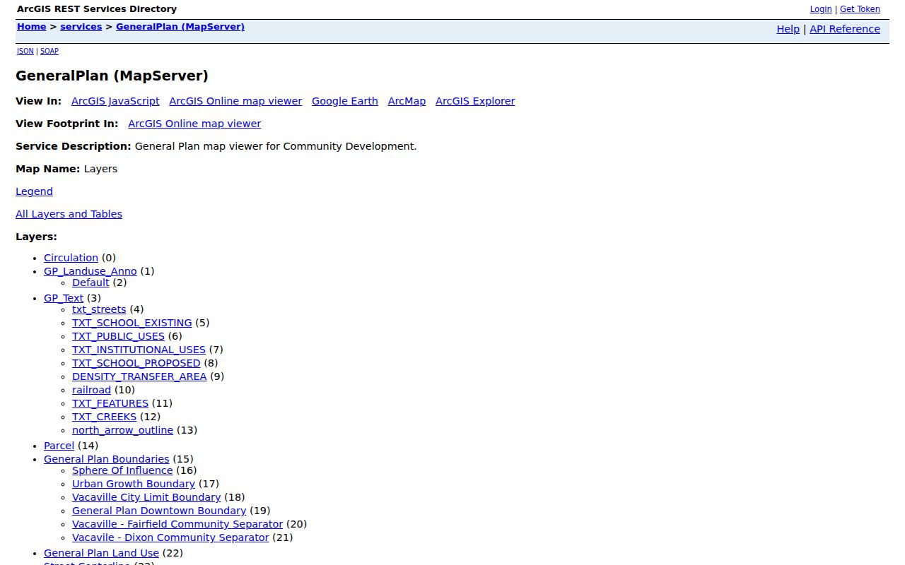
The map is strongest for geometry and jurisdiction. Use the APN and exact situs as the bridge to records that the GIS viewer deliberately leaves out.
Vacaville Street Directory Coverage
Each address source answers a different question. An address record trail becomes more trustworthy when the map, parcel key, recorded instrument, project history, and historical list are kept in separate lanes. The table below shows the local handoff points and the limits that matter when reviewing a full street.
| Record set | Keeper | Street-level evidence | Access and limit |
|---|---|---|---|
| Citywide Basemap | Solano GIS / city viewer | APNs, situs points, structures, values, districts | Free map; no owner or tax-mail field |
| Property information | Solano Assessor | Address or APN entry point for the assessment unit | Free portal; public card fields require live verification |
| Official records index | Solano Recorder | Parties, document class, date, document number, and APN when indexed | Free metadata from 1955 forward; no street search or online images |
| Projects and permits | Vacaville eTRAKiT | Project address, unit, APN, contacts, status, and chronology | Free search; contacts are dated project roles |
| Smythe directory | Vacaville Heritage Council | 1950 City Residents, Elmira, Rural Route, and map sections | Historical snapshot, not a current roster |
| Voter file | California Secretary of State / Solano Registrar | Registration data for an approved statutory purpose | Application, security, and use limits; no casual street list |
| Public-record request | City Clerk or county custodian | Identifiable existing city or county records | May not require a new resident roster to be compiled |
The APN is the strongest common key for present-day parcel work. It can connect a map feature to a Recorder search and can also appear in a project record. A street name supplies geography, but it does not make the Recorder index address-searchable or turn a dated project contact into a current occupant. That distinction keeps a Vacaville street directory useful without turning it into a claim about everyone at an address.
Note: A dated project contact can strengthen a parcel timeline, but it cannot replace a deed or prove who occupied the site.
Vacaville Deed Chain by Address
The Solano Recorder holds deeds, liens, easements, maps, and other official filings, but its searchable index is built around parties and instruments. The Recorder search instructions give the official simple-search example “JOHN DOE 2014,” with punctuation optional. Advanced search adds grantor, grantee, date range, document number, and document class. Recent county instructions also indicate that APN or PIN may be entered in the appropriate search path.
The Recorder's results can show a document number, recording date, page count, description or title, grantor and grantee, and sometimes an APN. They do not provide online images through the index. The absence of a street-address field is the key local quirk: start with the parcel and then pivot to a party name or APN instead of trying repeated address spellings.
The Recorder's online and office computer index covers 1955 to the present. At that boundary, move to Fairfield books and microfilm for older work; the county states that the older research reaches back to 1848. For a copy, a mail request identifies the title, party, document number or book and page, recording date, and phone number. There are no email copies. Current copy charges are $9 for the first page, $1 for each additional page, and $5 for certification.
The official Recorder instructions are the source for the search screen shown here.
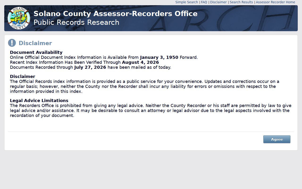
The screen illustrates a party-based index. The deed copy and its legal description, rather than the search result alone, are what let the earlier party be followed backward.
- Party names, including grantor and grantee spelling and order.
- Document number, plus book and page for older references.
- Recording date, document description or class, and page count.
- APN where the index includes it, which can confirm the parcel pivot.
- No online image in the index, so an identified copy or counter request is separate.
Vacaville Street Numbers and Plats
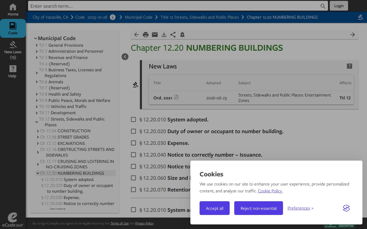
Vacaville Municipal Code Chapter 12.20 gives the numbering system a local shape. Blocks generally contain 100 numbers, with 50 numbers on each side, proportioned to frontage. West Street and the Sacramento, Callen, and North Street axes help determine direction. North and east sides use odd numbers; south and west sides use even numbers. An irregular or noncontinuous street may begin at 1, and a curve is measured along its centerline.
The Vacaville street-numbering code is the source for the rules image below. West of West Street, numbers run east to west; east of West Street, they run west to east. North of the Sacramento, Callen, or North Street axis, numbering runs south to north; south of it, north to south. The code also describes the usual even-right and odd-left relationship from a logical feeding street.
There is no official dated citywide renumbering found in the research. When an old address does not line up, compare plats, legal descriptions, parcel lineage, and the Clerk-held official numbering map. An owner or occupant can ask the Clerk for the correct assigned number rather than infer one from a neighboring lot.
- Parcel
- The assessment unit identified by an APN. One parcel can contain more than one structure or unit.
- Situs address
- The physical address assigned to the land or building. It is not automatically the tax-mail destination.
- Plat
- A recorded map that lays out lots, blocks, streets, easements, and subdivision relationships.
- Criss-cross directory
- A reverse directory method that starts with an address and points toward a name, usually for a dated historical list.
Note: A street-number rule can explain sequence, but a plat and APN establish which legal parcel the number describes.
Vacaville Permit Clues by Address
Permit and project files add a dated layer to address research. Vacaville's eTRAKiT project search accepts project number, project type, issued date, an operator such as Begins With, Contains, Equals, At Least, or At Most, and a value. A map on or off choice supports the search. Results are shown 20 at a time and can be printed or exported to Excel.
The eTRAKiT project view below comes from that official search entry point.
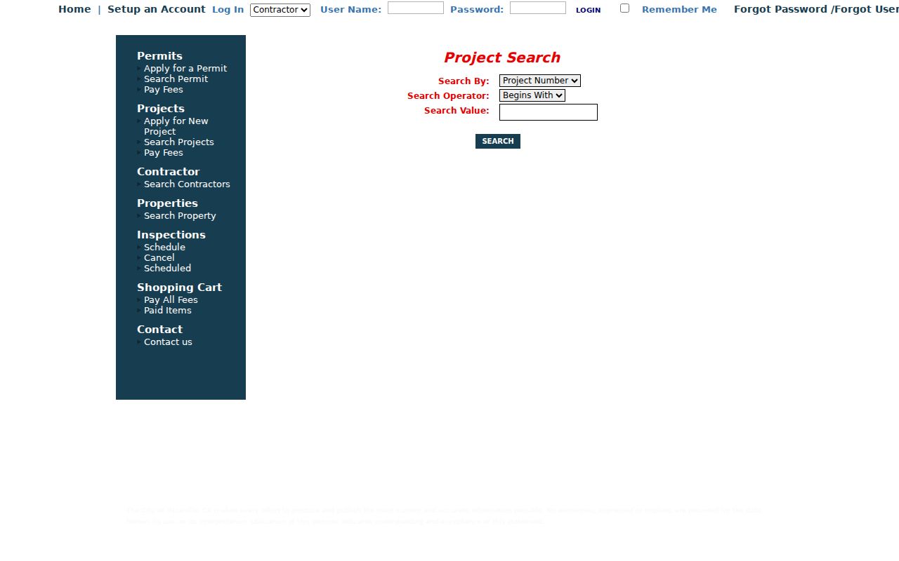
Open a result to compare its Project, Site, Contacts, Fees, Inspections, Conditions, Reviews, and Chronology tabs. A project may include an address or unit, APN, applicant, owner, contractor and license contact, proposed use, disciplines, value or area, and subdivision or lot details. Building records can also include model, garage, bed, bath, story, and water-meter fields for applicable work.
Those contacts are roles in a dated project. They can help explain a parcel's development history, but they do not identify every person who used the address. The building desk is (707) 449-5152, and inspections are handled at (707) 999-7113 when a search result needs a city contact or status clarification.
Vacaville Criss-Cross Directory Clues
A criss-cross directory reverses the usual name-first order. The researcher starts with a street and address, then reads across to a household or telephone clue. Vacaville's verified May 1950 Smythe City and Rural Directory is a particularly useful local example. The Vacaville Heritage Council catalog entry identifies City Residents, Elmira, Rural Route, city and rural maps, a Personal Telephone List, an Organizations Directory, and a Church Directory.
That structure reaches beyond the compact city grid. An older Vacaville-associated household may appear under Elmira or a rural route rather than under the modern street spelling. The verified source is one 1950 volume, not an exhaustive run of annual reverse directories, so label it as a dated snapshot. Pair a strong entry with a deed, map, newspaper notice, or census household before treating it as evidence of a person at a particular address. The Vacaville city directories collection page is the natural next stop when the historical shelf itself, rather than the current street chain, needs close review.
Vacaville Address Records: Situs and Mailing
Address records use similar words for different roles. A situs address locates the parcel. A tax-mail addressee receives correspondence. An owner or recorded party is tied to a deed or assessment record. An applicant signs onto a permit or project. An occupant is the person who uses the place. Those roles may overlap, but no single one proves all the others.
| Role or label | What it can establish | What it cannot establish alone |
|---|---|---|
| Parcel / APN | The assessment unit and its map relationship. | That every structure or person at the site is the same legal unit. |
| Situs address | The physical location used by GIS, assessment, and project records. | Who currently stays there. |
| Owner or recorded party | A title or transfer role tied to a dated instrument. | That the person occupies the property. |
| Tax-mail addressee | Where assessment correspondence is sent. | That the mailing destination matches the situs or household. |
| Applicant or project contact | A dated role in a permit or city project. | A complete list of residents. |
| Occupant | Actual use of the premises when supported by a reliable, lawful source. | A fact supplied by the assessor, GIS, deed index, or permit alone. |
This comparison is why a Vacaville address record trail should use careful verbs: “recorded as,” “listed at,” “applied for,” or “appeared in the 1950 directory.” “Lives there” is a stronger claim and needs evidence that the public address chain does not routinely provide.
Vacaville ZIP and Street Lines
A postal Vacaville label is not the same as an incorporated-city boundary. The current delivery list associates Vacaville with ZIP codes 95687, 95688, and 95696, but an exact address should be checked through the USPS ZIP lookup. ZIP routing can guide a search, yet it does not select the city, county, planning, police, or permit custodian.
The geography is especially important around growth areas. The Northeast Growth Area covers about 1,400 acres, split between 611 city acres and 789 unincorporated acres. East of Leisure Town Road covers 1,317 acres, split between 669 city acres and 648 unincorporated acres. Both areas sit within the Urban Growth Boundary and may be annexed after approvals. The General Plan map service separates City Limit, parcels, streets, the Urban Growth Boundary, and the Sphere of Influence. Development Engineering handles subdivisions, lot-line adjustments, annexations, easements, and district creation, so a new or shifted address may need an engineering or Clerk record rather than a postal assumption.
For address-by-address research, verify the parcel jurisdiction before choosing a custodian. The postal name can remain stable while city authority, county records, and development files follow a different line.
Note: ZIP routing narrows geography, while the parcel jurisdiction decides which local office holds the record.
Vacaville Voter Data by Street
California My Voter Status is a self-authentication tool, not a public by-name voter roll. The official voter-status form asks the voter to match personal identifiers before showing registration information. That design blocks a casual sweep of every name connected to a street.
- First and last name are required for the personal match.
- Date of birth is entered through month, day, and year controls.
- California driver license or ID digits may be used as a conditional identifier.
- The last four Social Security digits are an alternative conditional identifier.
- Submit and Reset controls complete the check; the portal advises closing the browser afterward.
The authenticated result can show the requester's registration status and address, party preference, polling place, ballot status, and election information. It does not authorize a third party to turn those fields into a neighborhood list. A qualified-purpose voter-file application is a separate process under Elections Code sections 2187 and 2194 and related regulations.
Approved applicants must identify the purpose and beneficiary, describe the geography and files requested, agree to security and use limits, and sign under penalty of perjury. The state fee is $15 per 1,000 records, with a $15 minimum and $100 maximum; a specific voter request is $30 each, up to ten, with the same $100 ceiling. The Solano Registrar of Voters is at 675 Texas Street, Suite 2600, Fairfield, (707) 784-6675. For Vacaville address research, that process is a narrow statutory channel, not a casual address lookup.
Vacaville Directory Privacy Limits
An address trail can connect public parcel, project, deed, map, and historical evidence, but it cannot turn those sources into a household roster. DMV addresses, utility and delivery customer lists, confidential voter registrations, and Safe at Home substitute addresses stay outside an ordinary street search. The California Public Records Act request route can seek an identifiable existing city or county record, yet it generally does not require the custodian to create a new list of residents.
Lawful personal use. Vacaville address records are for lawful research, family history, property understanding, and similar personal purposes. Using records to stalk, harass, intimidate, or harm another person can bring civil or criminal consequences under California law.
When a result matters, confirm it with the office that keeps the record. Use the Assessor for parcel questions, the Recorder for an identified instrument, GIS for geometry and jurisdiction, eTRAKiT for a dated project trail, and the City Clerk for an existing city record. Narrow wording protects accuracy: a parcel is not a person, a tax-mail destination is not a situs, and a dated contact is not proof of current occupancy.